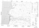
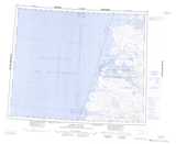
Maps showing Blue Fox Harbour, Franklin, Northwest Territories
Blue Fox Harbour is a Bay located in Franklin, Northwest Territories.
- Latitude: 72° 7' 1'' North (decimal: 72.1170600)
- Longitude: 125° 45' 11'' West (decimal: -125.7530518)
- Topography Feature Category: Bay
- Geographical Feature: Harbour
- Canadian Province/Territory: Northwest Territories
- Location: Franklin
- Atlas of Canada Locator Map: Blue Fox Harbour
- GPS Coordinate Locator Map: Blue Fox Harbour Lat/Long
Blue Fox Harbour NTS Map Sheets