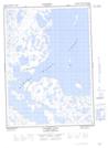
Maps showing Bonnieville Point, Mackenzie, Northwest Territories
Bonnieville Point is a Cape located in Mackenzie, Northwest Territories and has an elevation of 12 meters.
- Latitude: 68° 50' 20'' North (decimal: 68.8388295)
- Longitude: 133° 24' 10'' West (decimal: -133.4026625)
- Topography Feature Category: Cape
- Geographical Feature: Point
- Canadian Province/Territory: Northwest Territories
- Elevation: 12 meters
- Location: Mackenzie
- Atlas of Canada Locator Map: Bonnieville Point
- GPS Coordinate Locator Map: Bonnieville Point Lat/Long
Bonnieville Point NTS Map Sheets