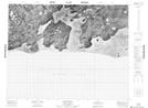
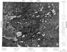
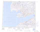
Maps showing Boot Inlet, Franklin, Northwest Territories
Boot Inlet is a Bay located in Franklin, Northwest Territories.
- Latitude: 71° 26' 2'' North (decimal: 71.4338047)
- Longitude: 117° 28' 9'' West (decimal: -117.4690455)
- Topography Feature Category: Bay
- Geographical Feature: Inlet
- Canadian Province/Territory: Northwest Territories
- Location: Franklin
- Atlas of Canada Locator Map: Boot Inlet
- GPS Coordinate Locator Map: Boot Inlet Lat/Long
Boot Inlet NTS Map Sheets