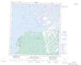
Maps showing Butte Island, Mackenzie, Northwest Territories
Butte Island is a Island located in Mackenzie, Northwest Territories and has an elevation of 161 meters.
- Latitude: 61° 43' 50'' North (decimal: 61.7306914)
- Longitude: 113° 19' 19'' West (decimal: -113.3219686)
- Topography Feature Category: Island
- Geographical Feature: Island
- Canadian Province/Territory: Northwest Territories
- Elevation: 161 meters
- Location: Mackenzie
- Atlas of Canada Locator Map: Butte Island
- GPS Coordinate Locator Map: Butte Island Lat/Long
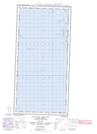
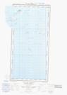
Butte Island NTS Map Sheets