Maps showing Canrobert Hills, Franklin, Northwest Territories
Canrobert Hills is a Mountain located in Franklin, Northwest Territories.
- Latitude: 76° 1' 2'' North (decimal: 76.0173558)
- Longitude: 115° 50' 10'' West (decimal: -115.8362209)
- Topography Feature Category: Mountain
- Geographical Feature: Hills
- Canadian Province/Territory: Northwest Territories
- Location: Franklin
- Atlas of Canada Locator Map: Canrobert Hills
- GPS Coordinate Locator Map: Canrobert Hills Lat/Long
Canrobert Hills NTS Map Sheets
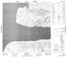
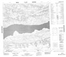
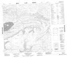
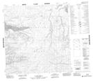
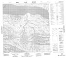
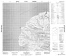
088G16 Ibbett Bay Topographic Map at 1:50,000 scale
088H13 No Title Topographic Map at 1:50,000 scale
088H14 Leopold Glacier Topographic Map at 1:50,000 scale
089A03 No Title Topographic Map at 1:50,000 scale
089A04 Marie Bay Topographic Map at 1:50,000 scale
089B01 Cape De Bray Topographic Map at 1:50,000 scale
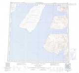
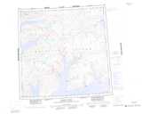
088G Eglinton Island Topographic Map at 1:250,000 scale
088H Murray Inlet Topographic Map at 1:250,000 scale
089A Emerald Isle Topographic Map at 1:250,000 scale
089B Intrepid Inlet Topographic Map at 1:250,000 scale