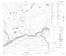
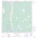
Maps showing Cape Island, Mackenzie, Northwest Territories
Cape Island is a Island located in Mackenzie, Northwest Territories.
- Latitude: 61° 22' 0'' North (decimal: 61.3667697)
- Longitude: 122° 2' 6'' West (decimal: -122.0348636)
- Topography Feature Category: Island
- Geographical Feature: Islands
- Canadian Province/Territory: Northwest Territories
- Location: Mackenzie
- Atlas of Canada Locator Map: Cape Island
- GPS Coordinate Locator Map: Cape Island Lat/Long
Cape Island NTS Map Sheets