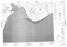
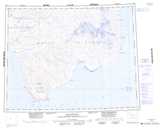
Maps showing Cardwell Brook, Franklin, Northwest Territories
Cardwell Brook is a River located in Franklin, Northwest Territories.
- Latitude: 71° 25' 2'' North (decimal: 71.4171103)
- Longitude: 121° 6' 10'' West (decimal: -121.1026638)
- Topography Feature Category: River
- Geographical Feature: Brook
- Canadian Province/Territory: Northwest Territories
- Location: Franklin
- Atlas of Canada Locator Map: Cardwell Brook
- GPS Coordinate Locator Map: Cardwell Brook Lat/Long
Cardwell Brook NTS Map Sheets