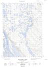
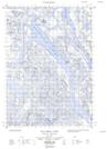
Maps showing Caribou Hills, Mackenzie, Northwest Territories
Caribou Hills is a Mountain located in Mackenzie, Northwest Territories and has an elevation of 160 meters.
- Latitude: 68° 45' 00'' North (decimal: 68.7499119)
- Longitude: 134° 14' 10'' West (decimal: -134.2359758)
- Topography Feature Category: Mountain
- Geographical Feature: Hills
- Canadian Province/Territory: Northwest Territories
- Elevation: 160 meters
- Location: Mackenzie
- Atlas of Canada Locator Map: Caribou Hills
- GPS Coordinate Locator Map: Caribou Hills Lat/Long
Caribou Hills NTS Map Sheets
107B10E Noell Lake Topographic Map at 1:50,000 scale
107B10W Noell Lake Topographic Map at 1:50,000 scale
107B11E Reindeer Station Topographic Map at 1:50,000 scale
107B11W Reindeer Station Topographic Map at 1:50,000 scale
107B14E Wolverine Lakes Topographic Map at 1:50,000 scale
107B14W Wolverine Lakes Topographic Map at 1:50,000 scale
107B Aklavik Topographic Map at 1:250,000 scale