Canada Topographic Maps

Caribou River Topo Maps

Topography maps and Latitude/Longitude Location

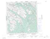
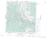
Maps showing Caribou River, Mackenzie, Northwest Territories

Caribou River is a River located in Mackenzie, Northwest Territories and has an elevation of 726 meters.

  • Latitude: 61° 27' 00'' North   (decimal: 61.4499428)
  • Longitude: 125° 47' 6'' West   (decimal: -125.7849820)
  • Topography Feature Category: River
  • Geographical Feature: River
  • Canadian Province/Territory: Northwest Territories
  • Elevation: 726 meters
  • Location: Mackenzie
  • Atlas of Canada Locator Map: Caribou River
  • GPS Coordinate Locator Map: Caribou River Lat/Long

Caribou River NTS Map Sheets

095D15 Last Mountain Topographic Map at 1:50,000 scale

095D16 No Title Topographic Map at 1:50,000 scale

095E01 Stonemarten Lakes Topographic Map at 1:50,000 scale

095E02 Skinboat Lakes Topographic Map at 1:50,000 scale

095E03 No Title Topographic Map at 1:50,000 scale

095E08 No Title Topographic Map at 1:50,000 scale

095F05 Mary River Topographic Map at 1:50,000 scale

095D Coal River Topographic Map at 1:250,000 scale

095E Flat River Topographic Map at 1:250,000 scale

095F Virginia Falls Topographic Map at 1:250,000 scale

 
Buy Topographic Maps DVD
Newsletter Sign-up

Yes, I want to receive map store discounts.


Bookmark and Share