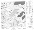
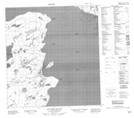
Maps showing Chedabucto Lake, Mackenzie, Northwest Territories
Chedabucto Lake is a Lake located in Mackenzie, Northwest Territories and has an elevation of 201 meters.
- Latitude: 62° 23' 16'' North (decimal: 62.3876907)
- Longitude: 115° 32' 5'' West (decimal: -115.5346510)
- Topography Feature Category: Lake
- Geographical Feature: Lake
- Canadian Province/Territory: Northwest Territories
- Elevation: 201 meters
- Location: Mackenzie
- Atlas of Canada Locator Map: Chedabucto Lake
- GPS Coordinate Locator Map: Chedabucto Lake Lat/Long
Chedabucto Lake NTS Map Sheets