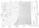
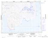
Maps showing Coal Mine Bluffs, Franklin, Northwest Territories
Coal Mine Bluffs is a Cliff located in Franklin, Northwest Territories.
- Latitude: 71° 35' 47'' North (decimal: 71.5962978)
- Longitude: 120° 26' 35'' West (decimal: -120.4429375)
- Topography Feature Category: Cliff
- Geographical Feature: Bluffs
- Canadian Province/Territory: Northwest Territories
- Location: Franklin
- Atlas of Canada Locator Map: Coal Mine Bluffs
- GPS Coordinate Locator Map: Coal Mine Bluffs Lat/Long
Coal Mine Bluffs NTS Map Sheets