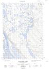
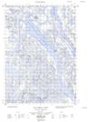
Maps showing Devil Creek, Mackenzie, Northwest Territories
Devil Creek is a River located in Mackenzie, Northwest Territories.
- Latitude: 68° 56' 10'' North (decimal: 68.9360223)
- Longitude: 134° 35' 25'' West (decimal: -134.5901757)
- Topography Feature Category: River
- Geographical Feature: Creek
- Canadian Province/Territory: Northwest Territories
- Location: Mackenzie
- Atlas of Canada Locator Map: Devil Creek
- GPS Coordinate Locator Map: Devil Creek Lat/Long
Devil Creek NTS Map Sheets