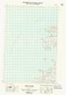
Maps showing Diamond Rock, Franklin, Northwest Territories
Diamond Rock is a Shoal located in Franklin, Northwest Territories and has an elevation of 0 meters.
- Latitude: 70° 2' 31'' North (decimal: 70.0419165)
- Longitude: 125° 8' 54'' West (decimal: -125.1484046)
- Topography Feature Category: Shoal
- Geographical Feature: Rock
- Canadian Province/Territory: Northwest Territories
- Elevation: 0 meters
- Location: Franklin
- Atlas of Canada Locator Map: Diamond Rock
- GPS Coordinate Locator Map: Diamond Rock Lat/Long
Diamond Rock NTS Map Sheets