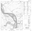
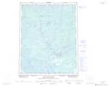
Maps showing Fossil Creek, Mackenzie, Northwest Territories
Fossil Creek is a River located in Mackenzie, Northwest Territories.
- Latitude: 66° 17' 30'' North (decimal: 66.2917067)
- Longitude: 128° 42' 2'' West (decimal: -128.7006659)
- Topography Feature Category: River
- Geographical Feature: Creek
- Canadian Province/Territory: Northwest Territories
- Location: Mackenzie
- Atlas of Canada Locator Map: Fossil Creek
- GPS Coordinate Locator Map: Fossil Creek Lat/Long
Fossil Creek NTS Map Sheets