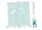
Maps showing Greyling Falls, Mackenzie, Northwest Territories
Greyling Falls is a Falls located in Mackenzie, Northwest Territories and has an elevation of 191 meters.
- Latitude: 62° 40' 21'' North (decimal: 62.6724243)
- Longitude: 114° 16' 20'' West (decimal: -114.2721122)
- Topography Feature Category: Falls
- Geographical Feature: Falls
- Canadian Province/Territory: Northwest Territories
- Elevation: 191 meters
- Location: Mackenzie
- Atlas of Canada Locator Map: Greyling Falls
- GPS Coordinate Locator Map: Greyling Falls Lat/Long
Greyling Falls NTS Map Sheets