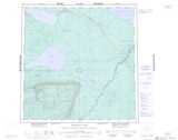
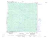
Maps showing Gull Creek, Mackenzie, Northwest Territories
Gull Creek is a River located in Mackenzie, Northwest Territories and has an elevation of 295 meters.
- Latitude: 60° 48' 0'' North (decimal: 60.8001099)
- Longitude: 117° 42' 5'' West (decimal: -117.7014113)
- Topography Feature Category: River
- Geographical Feature: Creek
- Canadian Province/Territory: Northwest Territories
- Elevation: 295 meters
- Location: Mackenzie
- Atlas of Canada Locator Map: Gull Creek
- GPS Coordinate Locator Map: Gull Creek Lat/Long
Gull Creek NTS Map Sheets