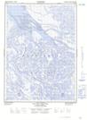
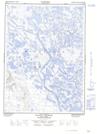
Maps showing Halkett Island, Mackenzie, Northwest Territories
Halkett Island is a Island located in Mackenzie, Northwest Territories.
- Latitude: 68° 30' 00'' North (decimal: 68.4998763)
- Longitude: 135° 0' 9'' West (decimal: -135.0025710)
- Topography Feature Category: Island
- Geographical Feature: Island
- Canadian Province/Territory: Northwest Territories
- Location: Mackenzie
- GPS Coordinate Locator Map: Halkett Island Lat/Long
Halkett Island NTS Map Sheets