Maps showing Harris Island, Mackenzie, Northwest Territories
Harris Island is a Island located in Mackenzie, Northwest Territories and has an elevation of 160 meters.
- Latitude: 61° 48' 31'' North (decimal: 61.8084848)
- Longitude: 113° 13' 29'' West (decimal: -113.2247275)
- Topography Feature Category: Island
- Geographical Feature: Island
- Canadian Province/Territory: Northwest Territories
- Elevation: 160 meters
- Location: Mackenzie
- Atlas of Canada Locator Map: Harris Island
- GPS Coordinate Locator Map: Harris Island Lat/Long
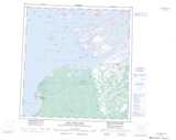
Harris Island NTS Map Sheets