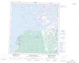
Maps showing Inconnu Channel, Mackenzie, Northwest Territories
Inconnu Channel is a Channel located in Mackenzie, Northwest Territories and has an elevation of 164 meters.
- Latitude: 61° 49' 11'' North (decimal: 61.8196159)
- Longitude: 112° 45' 4'' West (decimal: -112.7510557)
- Topography Feature Category: Channel
- Geographical Feature: Channel
- Canadian Province/Territory: Northwest Territories
- Elevation: 164 meters
- Location: Mackenzie
- Atlas of Canada Locator Map: Inconnu Channel
- GPS Coordinate Locator Map: Inconnu Channel Lat/Long
Inconnu Channel NTS Map Sheets