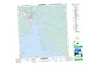
Maps showing Jackfish Lake, Mackenzie, Northwest Territories
Jackfish Lake is a Lake located in Mackenzie, Northwest Territories and has an elevation of 183 meters.
- Latitude: 62° 28' 6'' North (decimal: 62.4682530)
- Longitude: 114° 23' 30'' West (decimal: -114.3915535)
- Topography Feature Category: Lake
- Geographical Feature: Lake
- Canadian Province/Territory: Northwest Territories
- Elevation: 183 meters
- Location: Mackenzie
- Atlas of Canada Locator Map: Jackfish Lake
- GPS Coordinate Locator Map: Jackfish Lake Lat/Long
Jackfish Lake NTS Map Sheets