Canada Topographic Maps

Kugaluk River Topo Maps

Topography maps and Latitude/Longitude Location

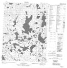
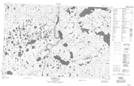
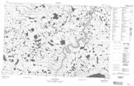
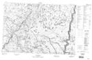
Maps showing Kugaluk River, Mackenzie, Northwest Territories

Kugaluk River is a River located in Mackenzie, Northwest Territories and has an elevation of 18 meters.

  • Latitude: 69° 8' 0'' North   (decimal: 69.1333435)
  • Longitude: 130° 58' 9'' West   (decimal: -130.9692723)
  • Topography Feature Category: River
  • Geographical Feature: River
  • Canadian Province/Territory: Northwest Territories
  • Elevation: 18 meters
  • Location: Mackenzie
  • Atlas of Canada Locator Map: Kugaluk River
  • GPS Coordinate Locator Map: Kugaluk River Lat/Long

Kugaluk River NTS Map Sheets

106O13 No Title Topographic Map at 1:50,000 scale

107A04 Hyndman Lake Topographic Map at 1:50,000 scale

107A05 No Title Topographic Map at 1:50,000 scale

107A12 No Title Topographic Map at 1:50,000 scale

107A13 No Title Topographic Map at 1:50,000 scale

107A14 No Title Topographic Map at 1:50,000 scale

107D03 No Title Topographic Map at 1:50,000 scale

106O Travaillant Lake Topographic Map at 1:250,000 scale

107A Crossley Lakes Topographic Map at 1:250,000 scale

107D Stanton Topographic Map at 1:250,000 scale

 
Buy Topographic Maps DVD
Newsletter Sign-up

Yes, I want to receive map store discounts.


Bookmark and Share