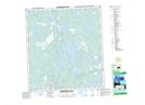
Maps showing Landing Lake, Mackenzie, Northwest Territories
Landing Lake is a Lake located in Mackenzie, Northwest Territories and has an elevation of 205 meters.
- Latitude: 62° 33' 36'' North (decimal: 62.5599213)
- Longitude: 114° 24' 35'' West (decimal: -114.4096146)
- Topography Feature Category: Lake
- Geographical Feature: Lake
- Canadian Province/Territory: Northwest Territories
- Elevation: 205 meters
- Location: Mackenzie
- Atlas of Canada Locator Map: Landing Lake
- GPS Coordinate Locator Map: Landing Lake Lat/Long
Landing Lake NTS Map Sheets