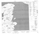
Maps showing Louise Islands, Mackenzie, Northwest Territories
Louise Islands is a Island located in Mackenzie, Northwest Territories.
- Latitude: 62° 24' 46'' North (decimal: 62.4126921)
- Longitude: 115° 15' 35'' West (decimal: -115.2596426)
- Topography Feature Category: Island
- Geographical Feature: Islands
- Canadian Province/Territory: Northwest Territories
- Location: Mackenzie
- Atlas of Canada Locator Map: Louise Islands
- GPS Coordinate Locator Map: Louise Islands Lat/Long
Louise Islands NTS Map Sheets