Canada Topographic Maps

Moose Channel Topo Maps

Topography maps and Latitude/Longitude Location

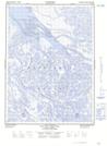
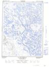
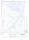
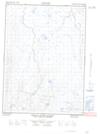
Maps showing Moose Channel, Mackenzie, Northwest Territories

Moose Channel is a Channel located in Mackenzie, Northwest Territories and has an elevation of 9 meters.

  • Latitude: 68° 46' 39'' North   (decimal: 68.7776306)
  • Longitude: 136° 27' 19'' West   (decimal: -136.4554153)
  • Topography Feature Category: Channel
  • Geographical Feature: Channel
  • Canadian Province/Territory: Northwest Territories
  • Elevation: 9 meters
  • Location: Mackenzie
  • Atlas of Canada Locator Map: Moose Channel
  • GPS Coordinate Locator Map: Moose Channel Lat/Long

Moose Channel NTS Map Sheets

107B12E Leland Channel Topographic Map at 1:50,000 scale

107B12W Leland Channel Topographic Map at 1:50,000 scale

117A09E Mount Davies Gilbert Topographic Map at 1:50,000 scale

117A09W Mount Davies Gilbert Topographic Map at 1:50,000 scale

117A16E Tent Island Topographic Map at 1:50,000 scale

117A16W Tent Island Topographic Map at 1:50,000 scale

107B Aklavik Topographic Map at 1:250,000 scale

117A Blow River Topographic Map at 1:250,000 scale

 
Buy Topographic Maps DVD
Newsletter Sign-up

Yes, I want to receive map store discounts.


Bookmark and Share