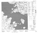
Maps showing Old Fort Rae, Mackenzie, Northwest Territories
Old Fort Rae is a Unincorporated area located in Mackenzie, Northwest Territories.
- Latitude: 62° 39' 1'' North (decimal: 62.6501997)
- Longitude: 115° 50' 5'' West (decimal: -115.8346727)
- Topography Feature Category: Unincorporated area
- Geographical Feature: Locality
- Canadian Province/Territory: Northwest Territories
- Location: Mackenzie
- Atlas of Canada Locator Map: Old Fort Rae
- GPS Coordinate Locator Map: Old Fort Rae Lat/Long
Old Fort Rae NTS Map Sheets