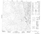
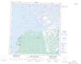
Maps showing Oracha Falls, Mackenzie, Northwest Territories
Oracha Falls is a Falls located in Mackenzie, Northwest Territories and has an elevation of 174 meters.
- Latitude: 61° 4' 41'' North (decimal: 61.0779208)
- Longitude: 112° 34' 59'' West (decimal: -112.5830337)
- Topography Feature Category: Falls
- Geographical Feature: Falls
- Canadian Province/Territory: Northwest Territories
- Elevation: 174 meters
- Location: Mackenzie
- Atlas of Canada Locator Map: Oracha Falls
- GPS Coordinate Locator Map: Oracha Falls Lat/Long
Oracha Falls NTS Map Sheets