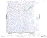
Maps showing Radford River, Mackenzie, Northwest Territories
Radford River is a River located in Mackenzie, Northwest Territories.
- Latitude: 63° 39' 1'' North (decimal: 63.6502977)
- Longitude: 104° 42' 3'' West (decimal: -104.7007409)
- Topography Feature Category: River
- Geographical Feature: River
- Canadian Province/Territory: Northwest Territories
- Location: Mackenzie
- Atlas of Canada Locator Map: Radford River
- GPS Coordinate Locator Map: Radford River Lat/Long
Radford River NTS Map Sheets