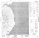
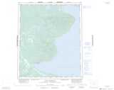
Maps showing Russel Bay, Mackenzie, Northwest Territories
Russel Bay is a Bay located in Mackenzie, Northwest Territories.
- Latitude: 65° 28' 31'' North (decimal: 65.4751498)
- Longitude: 122° 53' 31'' West (decimal: -122.8920145)
- Topography Feature Category: Bay
- Geographical Feature: Bay
- Canadian Province/Territory: Northwest Territories
- Location: Mackenzie
- Atlas of Canada Locator Map: Russel Bay
- GPS Coordinate Locator Map: Russel Bay Lat/Long
Russel Bay NTS Map Sheets