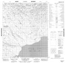
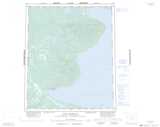
Maps showing Salatreil River, Mackenzie, Northwest Territories
Salatreil River is a River located in Mackenzie, Northwest Territories and has an elevation of 276 meters.
- Latitude: 65° 32' 56'' North (decimal: 65.5487667)
- Longitude: 122° 47' 16'' West (decimal: -122.7878505)
- Topography Feature Category: River
- Geographical Feature: River
- Canadian Province/Territory: Northwest Territories
- Elevation: 276 meters
- Location: Mackenzie
- Atlas of Canada Locator Map: Salatreil River
- GPS Coordinate Locator Map: Salatreil River Lat/Long
Salatreil River NTS Map Sheets