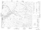
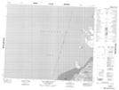
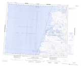
Maps showing Sea Otter Harbour, Franklin, Northwest Territories
Sea Otter Harbour is a Bay located in Franklin, Northwest Territories.
- Latitude: 72° 36' 2'' North (decimal: 72.6004249)
- Longitude: 125° 0' 11'' West (decimal: -125.0030712)
- Topography Feature Category: Bay
- Geographical Feature: Harbour
- Canadian Province/Territory: Northwest Territories
- Location: Franklin
- Atlas of Canada Locator Map: Sea Otter Harbour
- GPS Coordinate Locator Map: Sea Otter Harbour Lat/Long
Sea Otter Harbour NTS Map Sheets