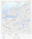
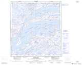
Maps showing Spur Islands, Mackenzie, Northwest Territories
Spur Islands is a Island located in Mackenzie, Northwest Territories.
- Latitude: 62° 23' 1'' North (decimal: 62.3835828)
- Longitude: 110° 17' 3'' West (decimal: -110.2843023)
- Topography Feature Category: Island
- Geographical Feature: Islands
- Canadian Province/Territory: Northwest Territories
- Location: Mackenzie
- Atlas of Canada Locator Map: Spur Islands
- GPS Coordinate Locator Map: Spur Islands Lat/Long
Spur Islands NTS Map Sheets