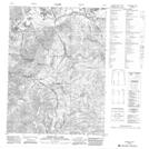
Maps showing Symmetry Mountain, Mackenzie, Northwest Territories
Symmetry Mountain is a Mountain located in Mackenzie, Northwest Territories and has an elevation of 790 meters.
- Latitude: 67° 42' 19'' North (decimal: 67.7053878)
- Longitude: 136° 13' 54'' West (decimal: -136.2316529)
- Topography Feature Category: Mountain
- Geographical Feature: Mountain
- Canadian Province/Territory: Northwest Territories
- Elevation: 790 meters
- Location: Mackenzie
- Atlas of Canada Locator Map: Symmetry Mountain
- GPS Coordinate Locator Map: Symmetry Mountain Lat/Long
Symmetry Mountain NTS Map Sheets