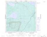
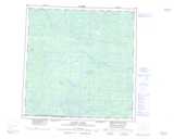
Maps showing Two Island Lake, Mackenzie, Northwest Territories
Two Island Lake is a Lake located in Mackenzie, Northwest Territories and has an elevation of 297 meters.
- Latitude: 60° 56' 0'' North (decimal: 60.9334446)
- Longitude: 118° 0' 5'' West (decimal: -118.0014161)
- Topography Feature Category: Lake
- Geographical Feature: Lake
- Canadian Province/Territory: Northwest Territories
- Elevation: 297 meters
- Location: Mackenzie
- Atlas of Canada Locator Map: Two Island Lake
- GPS Coordinate Locator Map: Two Island Lake Lat/Long
Two Island Lake NTS Map Sheets