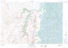
Maps showing Upper Canyon, Mackenzie, Northwest Territories
Upper Canyon is a Valley located in Mackenzie, Northwest Territories and has an elevation of 320 meters.
- Latitude: 68° 2' 29'' North (decimal: 68.0415153)
- Longitude: 135° 33' 59'' West (decimal: -135.5663954)
- Topography Feature Category: Valley
- Geographical Feature: Canyon
- Canadian Province/Territory: Northwest Territories
- Elevation: 320 meters
- Location: Mackenzie
- Atlas of Canada Locator Map: Upper Canyon
- GPS Coordinate Locator Map: Upper Canyon Lat/Long
Upper Canyon NTS Map Sheets