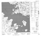
Maps showing Waite Island, Mackenzie, Northwest Territories
Waite Island is a Island located in Mackenzie, Northwest Territories and has an elevation of 174 meters.
- Latitude: 62° 34' 31'' North (decimal: 62.5751973)
- Longitude: 115° 36' 5'' West (decimal: -115.6013288)
- Topography Feature Category: Island
- Geographical Feature: Island
- Canadian Province/Territory: Northwest Territories
- Elevation: 174 meters
- Location: Mackenzie
- Atlas of Canada Locator Map: Waite Island
- GPS Coordinate Locator Map: Waite Island Lat/Long
Waite Island NTS Map Sheets