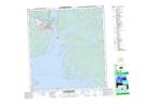
Maps showing Jackfish Draw, Mackenzie, Northwest Territories
Jackfish Draw is a Valley located in Mackenzie, Northwest Territories.
- Latitude: 62° 28' 11'' North (decimal: 62.4696422)
- Longitude: 114° 22' 15'' West (decimal: -114.3707188)
- Topography Feature Category: Valley
- Geographical Feature: Draw
- Canadian Province/Territory: Northwest Territories
- Location: Mackenzie
- Atlas of Canada Locator Map: Jackfish Draw
- GPS Coordinate Locator Map: Jackfish Draw Lat/Long
Jackfish Draw NTS Map Sheets