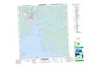
Maps showing School Draw, Mackenzie, Northwest Territories
School Draw is a Valley located in Mackenzie, Northwest Territories.
- Latitude: 62° 27' 6'' North (decimal: 62.4515862)
- Longitude: 114° 21' 25'' West (decimal: -114.3568287)
- Topography Feature Category: Valley
- Geographical Feature: Draw
- Canadian Province/Territory: Northwest Territories
- Location: Mackenzie
- Atlas of Canada Locator Map: School Draw
- GPS Coordinate Locator Map: School Draw Lat/Long
School Draw NTS Map Sheets