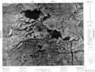
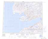
Maps showing Tahiluak, Northwest Territories
Tahiluak is a Lake located in Northwest Territories.
- Latitude: 71° 11' 59'' North (decimal: 71.1996311)
- Longitude: 116° 38' 3'' West (decimal: -116.6342105)
- Topography Feature Category: Lake
- Geographical Feature: Lake
- Canadian Province/Territory: Northwest Territories
- Atlas of Canada Locator Map: Tahiluak
- GPS Coordinate Locator Map: Tahiluak Lat/Long
Tahiluak NTS Map Sheets