Canada Topographic Maps

Ilgayaluk Topo Maps

Topography maps and Latitude/Longitude Location

Maps showing Ilgayaluk, Northwest Territories

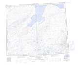
Ilgayaluk is a Lake located in Northwest Territories.

  • Latitude: 72° 0' 2'' North   (decimal: 72.0005206)
  • Longitude: 113° 30' 7'' West   (decimal: -113.5020633)
  • Topography Feature Category: Lake
  • Geographical Feature: Lake
  • Canadian Province/Territory: Northwest Territories
  • Atlas of Canada Locator Map: Ilgayaluk
  • GPS Coordinate Locator Map: Ilgayaluk Lat/Long

Ilgayaluk NTS Map Sheets

087H15 No Title Topographic Map at 1:50,000 scale

088A02 No Title Topographic Map at 1:50,000 scale

087H Saneraun Hills Topographic Map at 1:250,000 scale

088A Richard Collinson Inlet Topographic Map at 1:250,000 scale

 
Buy Topographic Maps DVD
Newsletter Sign-up

Yes, I want to receive map store discounts.


Bookmark and Share