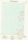
Maps showing Refuge d'oiseaux du Cap-Parry, Northwest Territories
Refuge d'oiseaux du Cap-Parry is a Conservation area located in Northwest Territories.
- Latitude: 70° 11' 24'' North (decimal: 70.19)
- Longitude: 124° 40' 12'' West (decimal: -124.67)
- Topography Feature Category: Conservation area
- Geographical Feature: Refuge d'oiseaux migrateurs
- Canadian Province/Territory: Northwest Territories
- Atlas of Canada Locator Map: Refuge d'oiseaux du Cap-Parry
- GPS Coordinate Locator Map: Refuge d'oiseaux du Cap-Parry Lat/Long
Refuge d'oiseaux du Cap-Parry NTS Map Sheets