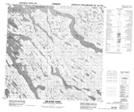
Maps showing Abloviak Fiord, Nunavut
Abloviak Fiord is a Bay located in Nunavut and has an elevation of 18 meters.
- Latitude: 59° 29' 45'' North (decimal: 59.4957999)
- Longitude: 65° 9' 5'' West (decimal: -65.1514000)
- Topography Feature Category: Bay
- Geographical Feature: Fiord
- Canadian Province/Territory: Nunavut
- Elevation: 18 meters
- GPS Coordinate Locator Map: Abloviak Fiord Lat/Long
Abloviak Fiord NTS Map Sheets