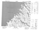
Maps showing Bell Inlet, Nunavut
Bell Inlet is a Bay located in Nunavut.
- Latitude: 59° 56' 32'' North (decimal: 59.9421999)
- Longitude: 65° 5' 25'' West (decimal: -65.0902999)
- Topography Feature Category: Bay
- Geographical Feature: Inlet
- Canadian Province/Territory: Nunavut
- Atlas of Canada Locator Map: Bell Inlet
- GPS Coordinate Locator Map: Bell Inlet Lat/Long
Bell Inlet NTS Map Sheets