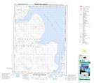
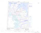
Maps showing Broughton Island, Nunavut
Broughton Island is a Hamlet located in Nunavut and has an elevation of 84 meters.
- Latitude: 67° 33' 17'' North (decimal: 67.5546999)
- Longitude: 64° 1' 41'' West (decimal: -64.0281000)
- Topography Feature Category: Hamlet
- Geographical Feature: Hamlet
- Canadian Province/Territory: Nunavut
- Elevation: 84 meters
- GPS Coordinate Locator Map: Broughton Island Lat/Long
Broughton Island NTS Map Sheets