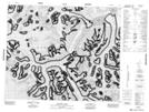
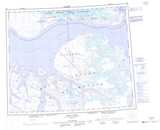
Maps showing Jimi Maasi Glacier, Nunavut
Jimi Maasi Glacier is a Glacier located in Nunavut.
- Latitude: 72° 27' 35'' North (decimal: 72.4597000)
- Longitude: 76° 3' 55'' West (decimal: -76.0653000)
- Topography Feature Category: Glacier
- Geographical Feature: Glacier
- Canadian Province/Territory: Nunavut
- Atlas of Canada Locator Map: Jimi Maasi Glacier
- GPS Coordinate Locator Map: Jimi Maasi Glacier Lat/Long
Jimi Maasi Glacier NTS Map Sheets