Maps showing Luigi d'Abruzzi Cape, Nunavut
Luigi d'Abruzzi Cape is a Cape located in Nunavut.
- Latitude: 68° 40' 20'' North (decimal: 68.6721999)
- Longitude: 95° 31' 30'' West (decimal: -95.5250000)
- Topography Feature Category: Cape
- Geographical Feature: Cape
- Canadian Province/Territory: Nunavut
- Atlas of Canada Locator Map: Luigi d'Abruzzi Cape
- GPS Coordinate Locator Map: Luigi d'Abruzzi Cape Lat/Long
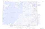
Luigi d'Abruzzi Cape NTS Map Sheets