Canada Topographic Maps

Richardson River Topo Maps

Topography maps and Latitude/Longitude Location

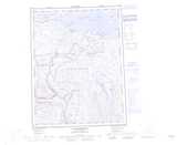
Maps showing Richardson River, Nunavut

Richardson River is a River located in Nunavut and has an elevation of 5 meters.

  • Latitude: 67° 54' 30'' North   (decimal: 67.9082999)
  • Longitude: 115° 31' 20'' West   (decimal: -115.5222000)
  • Topography Feature Category: River
  • Geographical Feature: River
  • Canadian Province/Territory: Nunavut
  • Elevation: 5 meters
  • Atlas of Canada Locator Map: Richardson River
  • GPS Coordinate Locator Map: Richardson River Lat/Long

Richardson River NTS Map Sheets

086M16 No Title Topographic Map at 1:50,000 scale

086N13 No Title Topographic Map at 1:50,000 scale

086N14 No Title Topographic Map at 1:50,000 scale

086N15 Cox Lake Topographic Map at 1:50,000 scale

086O13 No Title Topographic Map at 1:50,000 scale

086O14 Richardson Bay Topographic Map at 1:50,000 scale

086M Bebensee Lake Topographic Map at 1:250,000 scale

086N Dismal Lakes Topographic Map at 1:250,000 scale

086O Coppermine Topographic Map at 1:250,000 scale

 
Buy Topographic Maps DVD
Newsletter Sign-up

Yes, I want to receive map store discounts.


Bookmark and Share