Canada Topographic Maps

Sylvia River Topo Maps

Topography maps and Latitude/Longitude Location

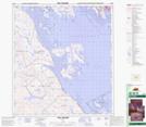
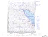
Maps showing Sylvia River, Nunavut

Sylvia River is a River located in Nunavut.

  • Latitude: 63° 44' North   (decimal: 63.7333000)
  • Longitude: 68° 34' West   (decimal: -68.5667000)
  • Topography Feature Category: River
  • Geographical Feature: River
  • Canadian Province/Territory: Nunavut
  • GPS Coordinate Locator Map: Sylvia River Lat/Long

Sylvia River NTS Map Sheets

025N10 Hill Island Topographic Map at 1:50,000 scale

025N15 Iqaluit Topographic Map at 1:50,000 scale

026C02 No Title Topographic Map at 1:50,000 scale

026C03 Anakudluk Lake Topographic Map at 1:50,000 scale

025N Armshow River Topographic Map at 1:250,000 scale

026C Sylvia Grinnell Lake Topographic Map at 1:250,000 scale

 
Buy Topographic Maps DVD
Newsletter Sign-up

Yes, I want to receive map store discounts.


Bookmark and Share