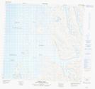
Maps showing Paungaqutiit Islands, Nunavut
Paungaqutiit Islands is a Island located in Nunavut.
- Latitude: 59° 12' 30'' North (decimal: 59.2083000)
- Longitude: 65° 53' 20'' West (decimal: -65.8888999)
- Topography Feature Category: Island
- Geographical Feature: Islands
- Canadian Province/Territory: Nunavut
- Atlas of Canada Locator Map: Paungaqutiit Islands
- GPS Coordinate Locator Map: Paungaqutiit Islands Lat/Long
Paungaqutiit Islands NTS Map Sheets