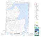
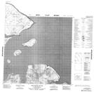
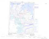
Maps showing Akuliaqatta Bluff, Nunavut
Akuliaqatta Bluff is a Mountain located in Nunavut and has an elevation of 235 meters.
- Latitude: 67° 44' 59'' North (decimal: 67.7496999)
- Longitude: 64° 22' 0'' West (decimal: -64.3666999)
- Topography Feature Category: Mountain
- Geographical Feature: Bluff
- Canadian Province/Territory: Nunavut
- Elevation: 235 meters
- Atlas of Canada Locator Map: Akuliaqatta Bluff
- GPS Coordinate Locator Map: Akuliaqatta Bluff Lat/Long
Akuliaqatta Bluff NTS Map Sheets