Elu Inlet Topo Map
Free Topo Maps Downloadable Online: 077A
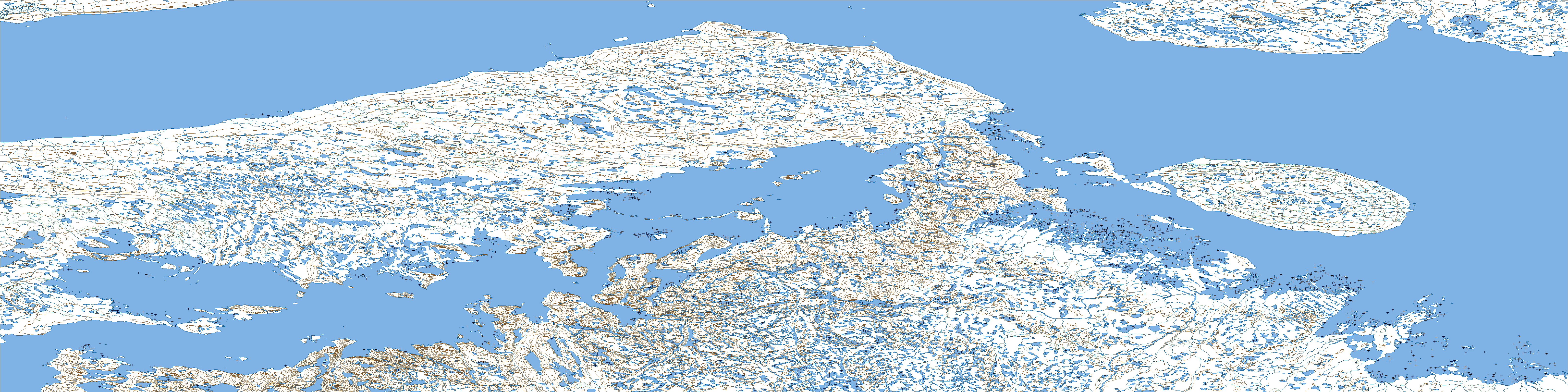
077A Elu Inlet Topo Map
To view this map, mouse over the map preview on the right.
You can also download this topo map for free:
077A Elu Inlet high-resolution topo map image.
Maps for the Elu Inlet map sheet 077A at 1:250,000 scale are also available in these 4 versions:
Elu Inlet Surrounding Area Topos (NTS 077)
 |
 |
 |
 |
 |
 |
 |
 |
© Department of Natural Resources Canada. All rights reserved.
077A Elu Inlet Area Topo Maps at 1:50,000
 |
 |
 |

|
 |
 |
 |
 |
 |
 |
 |
 |
 |
 |
 |
 |
© Department of Natural Resources Canada. All rights reserved.
© Department of Natural Resources Canada. All rights reserved.
077A Related Maps:
077A Elu Inlet077A01 Conolly Bay
077A02 Kuugaarjuk River
077A03 Hope Bay
077A04 Hurd Islands
077A05 Parry Bay
077A06 Warrender Bay
077A07 Labyrinth Bay
077A08 Dease Point
077A09 Melbourne Island
077A10 Minto Islands
077A11 Elu Inlet
077A12 No Title
077A13 Dease Strait
077A14 Cape Alexander
077A15 Cape Colborne
077A16E Anderson Bay
077A16W Anderson Bay
